

The changing nature of the Shackleton Traverse
We have completed the traverse, just under the wire of having to make the return passage to Port Stanley. A close-run thing. It is never good to leave a job undone with such a worthwhile objective to hand. After weeks of being on standby to sail around to King Haakon Bay we finally had a forecast for three days of reasonable weather after four horrendous days being blown about on anchor at Right Whale Bay with no visibility to speak of.
To begin this journey, to my way of thinking, you need a window of three days to comfortably get stuck in and committed. Day one was a predawn start from Right Whale Bay, taking five hours to slip through Bird Sound and enter King Haakon, dropping anchor near Cave Cove, a tiny indent almost hidden from view on Cape Rosa where Shackleton and his men first made landfall after leaving Elephant Island.

Cave Cove, the cave is on the right under the Swords of Damocles
This is where the story starts for us. We spent an hour ashore there inspecting the cave, which is nothing more than a miserable overhang, icy Swords of Damocles on guard overhead. Shackleton and his five companions heartily ate the wandering albatross chicks off the nest above the cove to regain their strength after their epic boat journey. Today there are no nests. The crew of Vinson was there in 2024 on the once in ten year wandering albatross survey for the government and we searched high and low all over the Cape.
We continued down the fjord that afternoon and with pulks, food bags, skis and the heavy gear ready, we dropped anchor behind the Vincent Islands near Peggoty Bluff and offloaded everything onto snow above the beach. A lone bull elephant seal took little notice as we intruded into his fastness.
Day two, the work began, taking our personal kit bags ashore just after first light, harnessing up to our pulks and beginning the long ski and skin up to the Shackleton Gap followed by a steep pull up on to the Murray Snowfield. On the Gap we radioed Vinson and said goodbye to Tor, Melissa, John, and Jerome - they could up anchor and head back around to the north side of the island.
Snow conditions were mixed, the high winds we had been experiencing on the island did their work here and instead of a flat pulling surface the winter snow of the glacier was a patchwork of mini summits – wind-blown ‘sastrugi,’ annoyingly at right angles to our direction of travel – more hauling energy required!
The South Col on the Razorback Ridge
The South Col on the Razorback, underneath Mt. Tethys

Antarctic Bay from the South Col on the Razorback Ridge
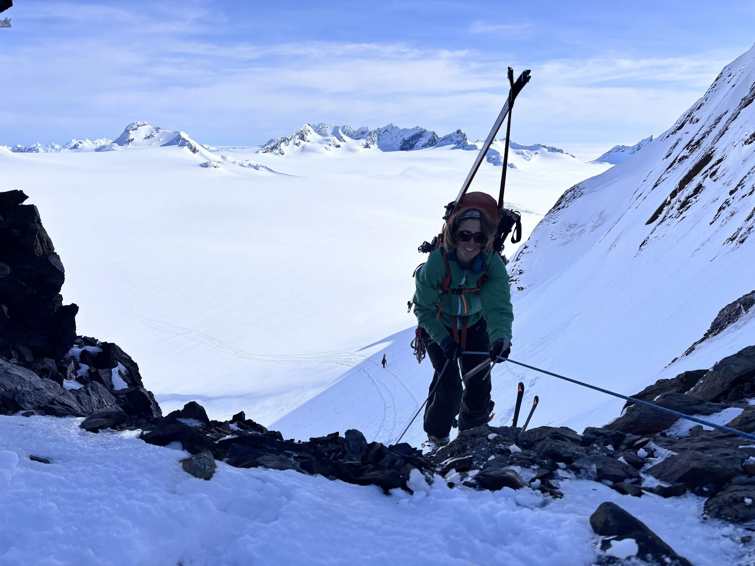
Luca lowering the pulk from the South Col
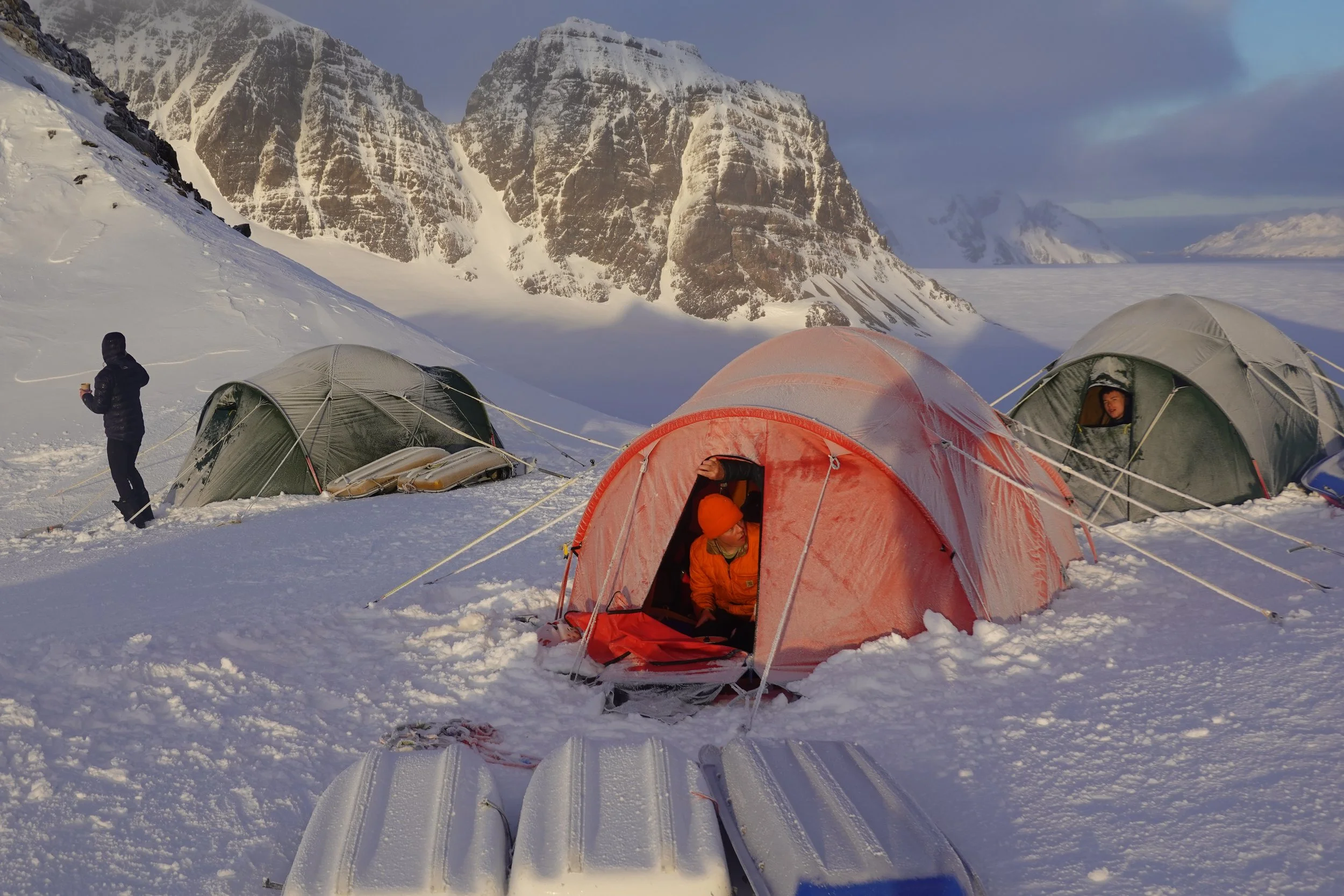
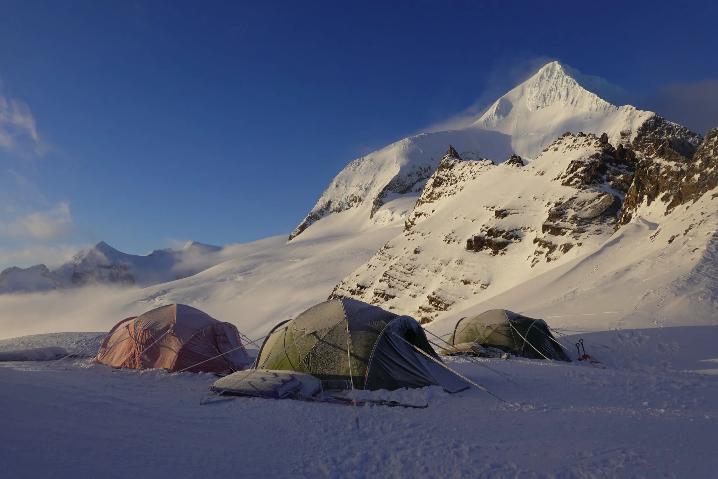
It was a long day. By 1600 I was trailing way behind our youthful contingent and after a steep pull up the last 100m (much steeper than when I was last here in 2011, or maybe it was 14 years tacked on to the equation!) we gained the south of three cols that define the Razorback Ridge where Shackleton, Worsley, and Crean made the famous desperate slide, in little visibility, off the crest of the north col into the abyss. In 2006 I did the north col, the higher of the three, in order to follow as best as possible ‘the route.’ In subsequent traverses we always used the centre col, first camping along the top of a wind scoop below the central peak entertained by nesting snow petrels on the cliffs above. That camping platform is no longer there. The south col was therefore an experiment that worked, but just. It was a hard ice platform, just big enough for our three tents – our ice screws came in more than handy for tent guy anchors. The forecast was benign for day three, but this was certainly an exposed position, with 10 degrees of frost overnight.
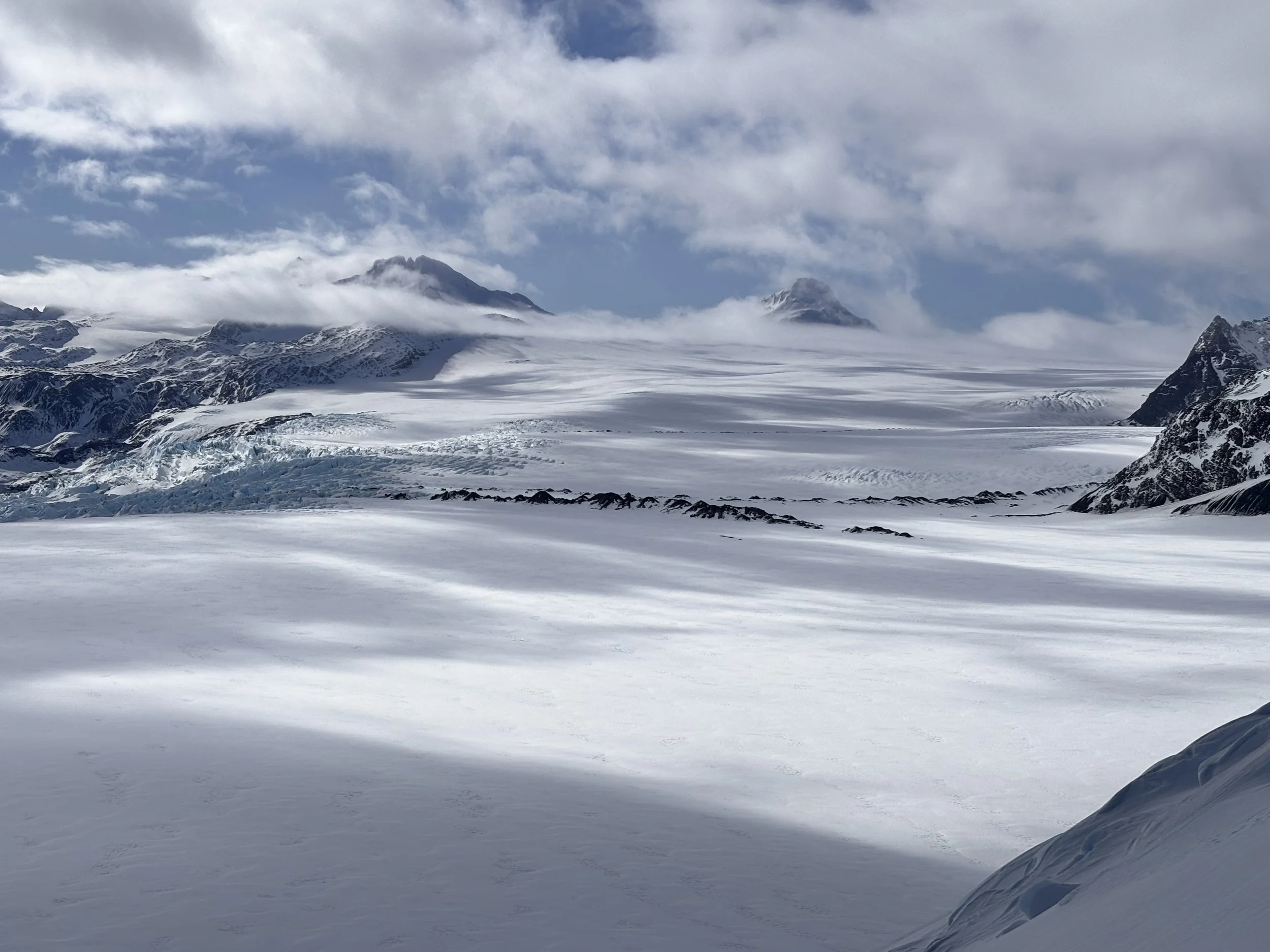
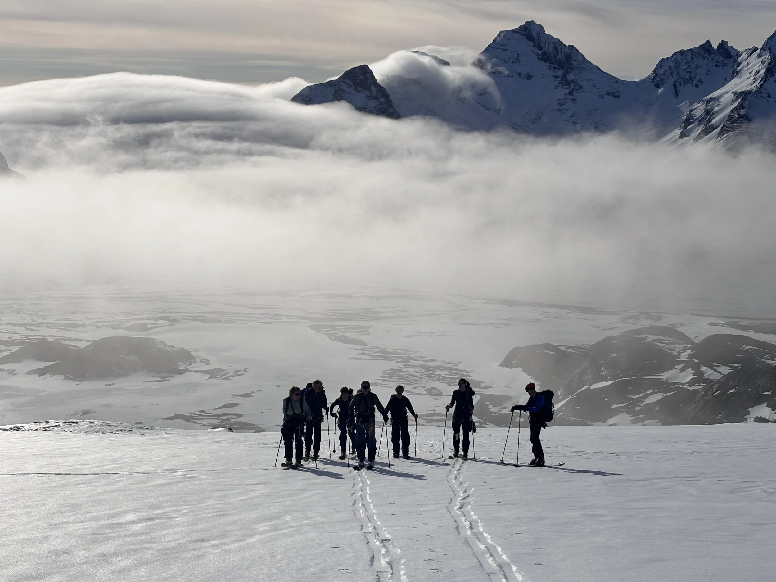
The next morning was a hard and windy start breaking camp. When I climbed out of our cacoon at 0600 we were in the mist - a concerning situation for the descent, but luckily it lifted by 0800 and we were met with spectacular views in both directions - back down the Murray into King Haakon Bay and due east along our route across the Compass Glacier immediately below, then the Crean Glacier and finally across the expansive Nineteen Sixteen Snowfield in the far distance. Optimism returned! And with that the shocker. Where I had been across that stretch four times previously, usually even a bit later in the season, it was a clean stretch of winter snow as far as the eye could see. Now we were looking at two substantial moraines descending down the Crean Glacier and the obvious conclusion was the glacier had down wasted, melting and ablating from top down revealing these rock features, meaning not much depth of true glacial ice is left. Everyone talks about glacial recession as it is tangible and easily measured over time - not so the depth of ice. You need to be there on it, to see it revealed by the bed rock trawled up into moraines which signals the beginning of the end of South Georgia’s ‘ice age.’
The two moraines appearing on the Crean Glacier

Steve Brown coils up on the Breakwind Gap, Fortuna Bay below
Hamish and Steve had done a recce down the descent the afternoon before and it was steep but doable, although with a joggle in the way down. An easy walk down in crampons, but with pulks a different story. We had to lower off along a fixed rope which was unwieldly for some and we consequently lingered in the operation far too long as seracs were threatening from above. Unless you are booting it down carrying rucsacs which is usually the mode of travel later in the season, this descent with pulks is not recommended. The central col is safer, steeper; therefore lowering off pulks and people down the ‘fall line’ is the preferred option.
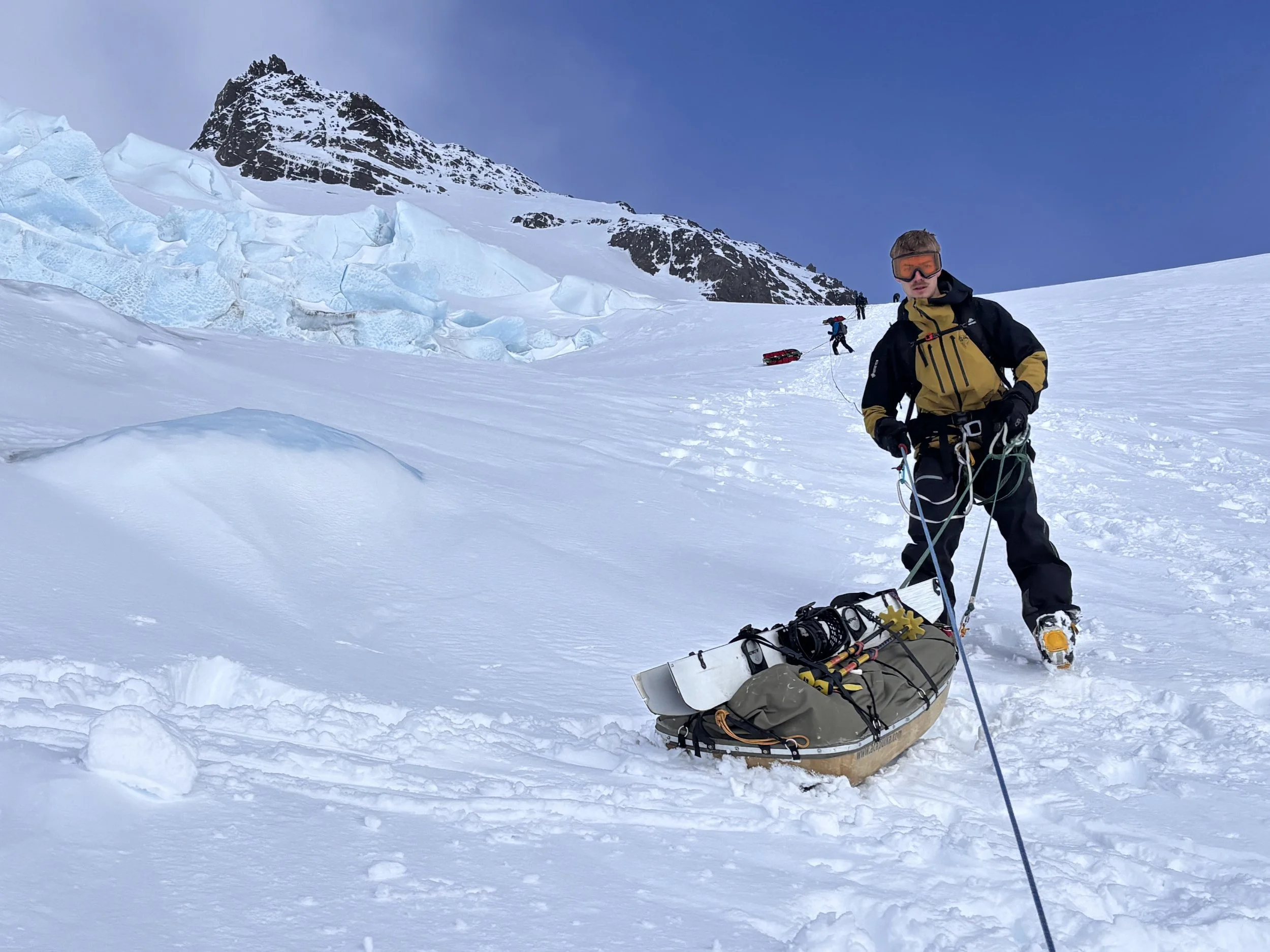
Once safely on the Compass Glacier we let it rip by riding the pulks in luge fashion down to the flat – the most fun of the day. It was 1230 by then so we continued on an undulating surface for another two hours to camp alongside the second moraine, a relaxed afternoon as we were sort of ‘out of the woods’ with regards the difficulties.

The Wessex helicopter on the Nineteen Sixteen Snowfield
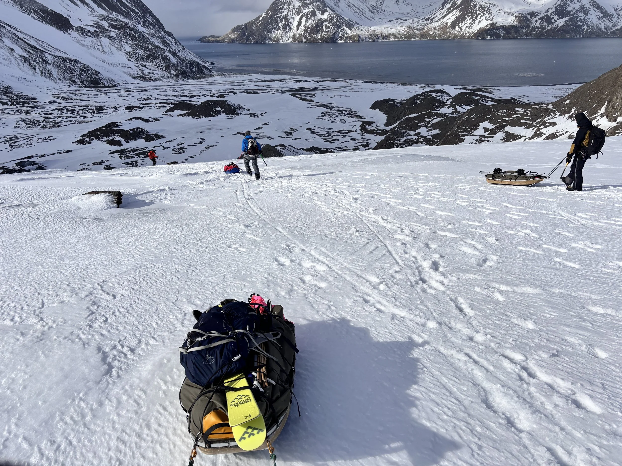
The next day, after passing the wrecked Wessex helicopter from the 1982 Falklands war (read ‘Operation Paraquat’ and ‘Across an Angry Sea’) which had moved 450 meters down slope with the glacier since I logged the position in 2006, we had to forego camping below the Caird Nunatak to use as a base for a day of climbing and skiing ‘light’ in the environs of the Fortuna Glacier which is a veritable paradise (on a good day). The forecast for day four was bad so the consensus was to carry on down the Turnback Glacier to the beach at Anchorage Bay and camp there. This is where Shackleton, Worsley, and Crean tried to descend but were met with a sheer glacial front ending in the sea. Today it is the normal descent route for everyone doing the Traverse as it is an easy ‘down and out’ - nothing more than an ice tongue covered in what was left of the winter snow.
Luca’s moment of truth came at the beginning of this descent near the Caird Nunatak. He was on a split snowboard – no problem on the ascents but hard to imagine descending with a pulk. It was a Bart Simpson moment – he took off and immediately zoomed by me, sitting on this pulk looking very smug and relaxed, the snow board edge steering his direction of travel. Yes, he must be ‘the first’ to do the Shackleton Traverse on a snowboard, but as he said “A first of absolutely no consequence.” I’m more impressed by that statement than the actual ‘first.’

Luca snowboarding down on his pulk
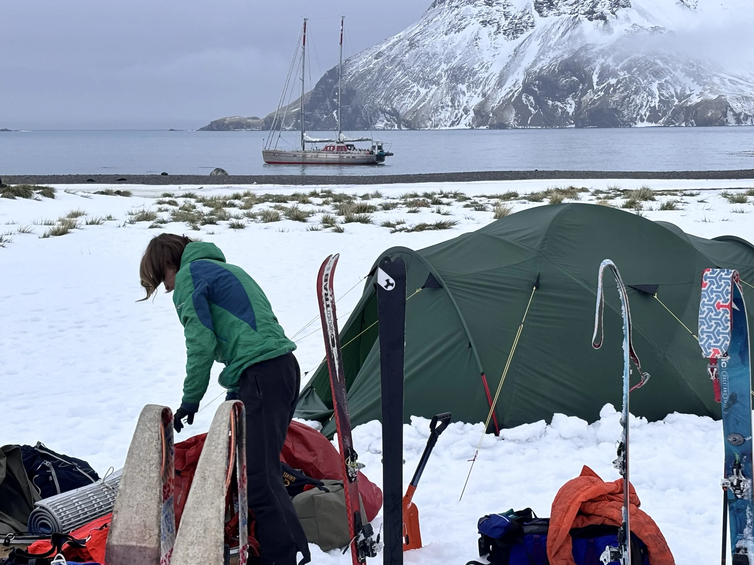
We camped late that afternoon on the edge of the outwash plain, behind some buttresses to avoid the likely wind blast coming down the Turnback. Next day we were happily tent bound in the pouring rain brought in from a strong northerly airstream. Lara, Luca, and I were very comfortable all reading Jack Kerouac. I was not adverse to a day off. Vinson was just around the corner at Husvik, a terrible temptation for some, but we held firm not wishing to break the spell of our journey.
Lara coming over the Breakwind Gap

Zu, Frank, Lara and Luca coming down the ravine after the Breakwind Gap

Titus, Hamish and Lenny below the rockfall zone in the ravine
Next day, a ‘dingle day,’ as the Kiwis would say, we went back up the Turnback Glacier and over the Breakwind Gap, where Shackleton, Worsely, and Crean could see the recognizable ‘zed stone,’ a folded strata above Stromness Bay and where they heard the 0630 whistle calling the whalers to work - they knew they had made it. It is an historic part of the journey and sadly few people do it as again, 14 years ago we had pulled pulks across it, easily skiing them down. The vestigial glacier on the east side of the pass is about gone and everything on the descent has steepened off, plus the ravine is gnarly, with rockfall threatening from above. And, with a yacht or cruise ship waiting near the beach at Anchorage Bay, well . . . that part of this historic journey is foregone in lieu of drinks and dinner on board.
Traverse Team above Anchorage Bay
Walking the pulks down the last section to Anchorage Bay
The camp at Anchorage Bay
The message here, without gainsaying Shackleton, Worsley, and Crean in the least, is that this famous journey is still worth doing, but it must be kept in mind the terrain bears little resemblance to what it was in 1916, let alone in 2011. When you read Shackleton’s ‘South’ keep that in mind.
On September 19th we did the tourist route from Fortuna Bay to the whaling station at Stromness - “The Last Day of the Shackleton Traverse,” the description of which can be found in any cruise ship brochure touting the island. Never-the-less it is a great day out, especially when our base camp Vinson of Antarctica is waiting for our return, jogging off the beach at Stromness.

Kenneth documenting the 'Last Day' Stromness Bay

Arrival on Stomness for the pick up That's it!

Shackleton traverse map

Skip Novak
Expedition Leader