

Five Days on Anvers Island
The Marr Ice Piedmont on Anvers Island is one of the most spectacular features in this part of Antarctica. As the name suggests, a ‘piedmont’ is a low-lying area at the foot of the mountains. The most famous is Italy’s Piedmont province on the southern side of the Alps. But the Anvers Island version is quite unlike anything in Europe – a vast white glacial plain sloping down almost imperceptibly from a range of icy mountains dominated by the vast bulk of Mt Français – the mountain named after the ship which brought Jean-Baptiste Charcot’s expedition here in 1903. David Marr was a more recent explorer and first commander of the Falklands Islands Dependencies Survey (now British Antarctic Survey) during the Second World War.
We skied up and down Mt Français in 2013 and 2016, and tried it again in 2020. This time I thought we would go for something slightly gentler – the neighbouring 1,550 m summit of Mt Rennie. Gentler, but still serious, with a 20 km approach from the little peninsula on Anvers’s western shore known as Access Point.
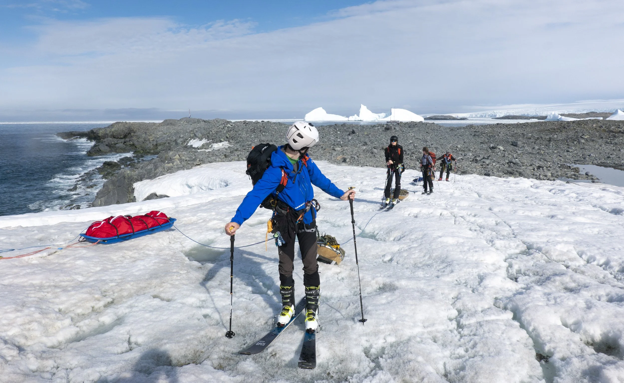
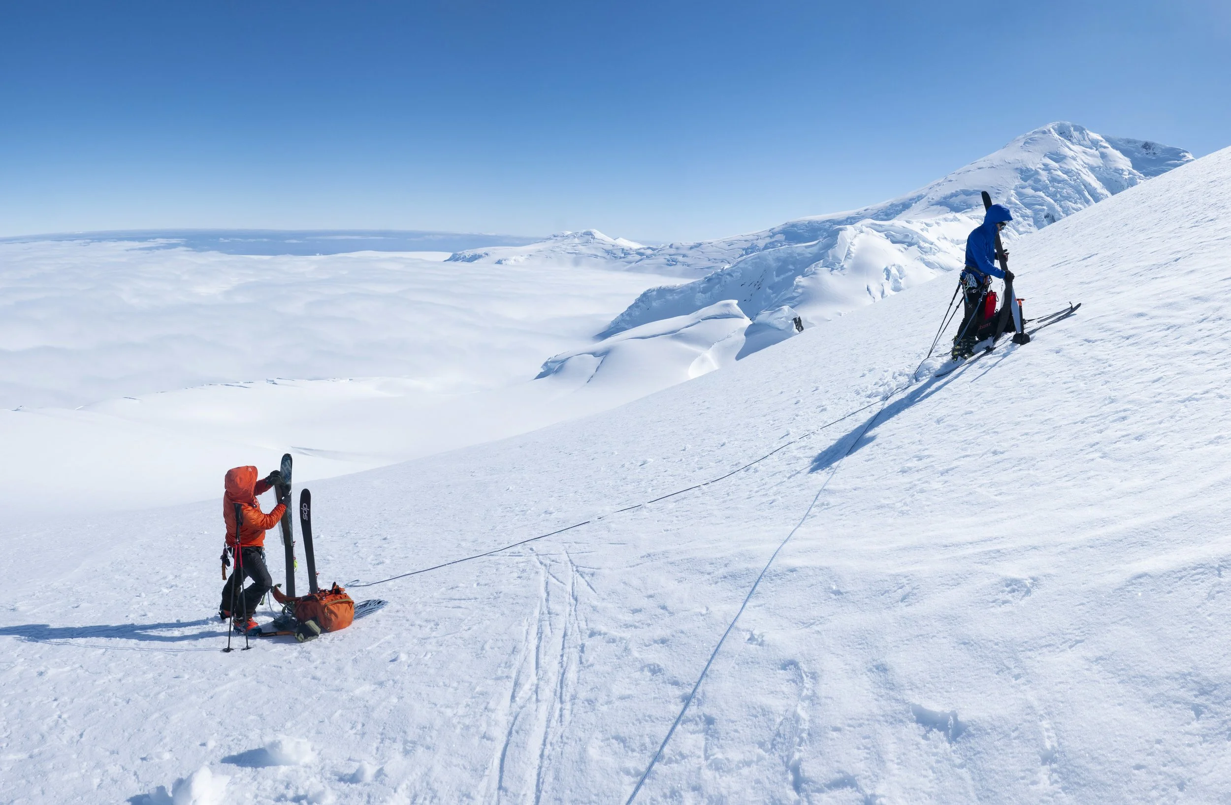
Ready to set off from Access Point. Photo: Stephen Venables
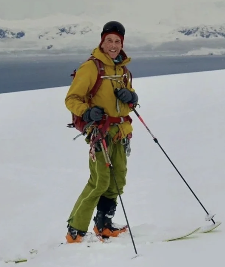
The name says it all. Getting ashore is often the biggest challenge in Antarctica, where ninety-five percent of the coastline is guarded by vertical tottering ice cliffs. At Access Point the glacier slopes conveniently down to a rocky shore, but you do still have to get a foothold on those rocks. At the first attempt we were defeated by a solid swathe of brash ice, undulating in the swell, making it impossible to control the Zodiac’s outboard motor. The next day we were luckier. The swell was down and the ice had all drifted back to sea. By 7.30 in the morning Lucas Krupp, Viola Iselin, Kristin Waplan, Manuel Lugli and I were all ashore with skis, pulks, tents and supplies for up to five days’ camping.
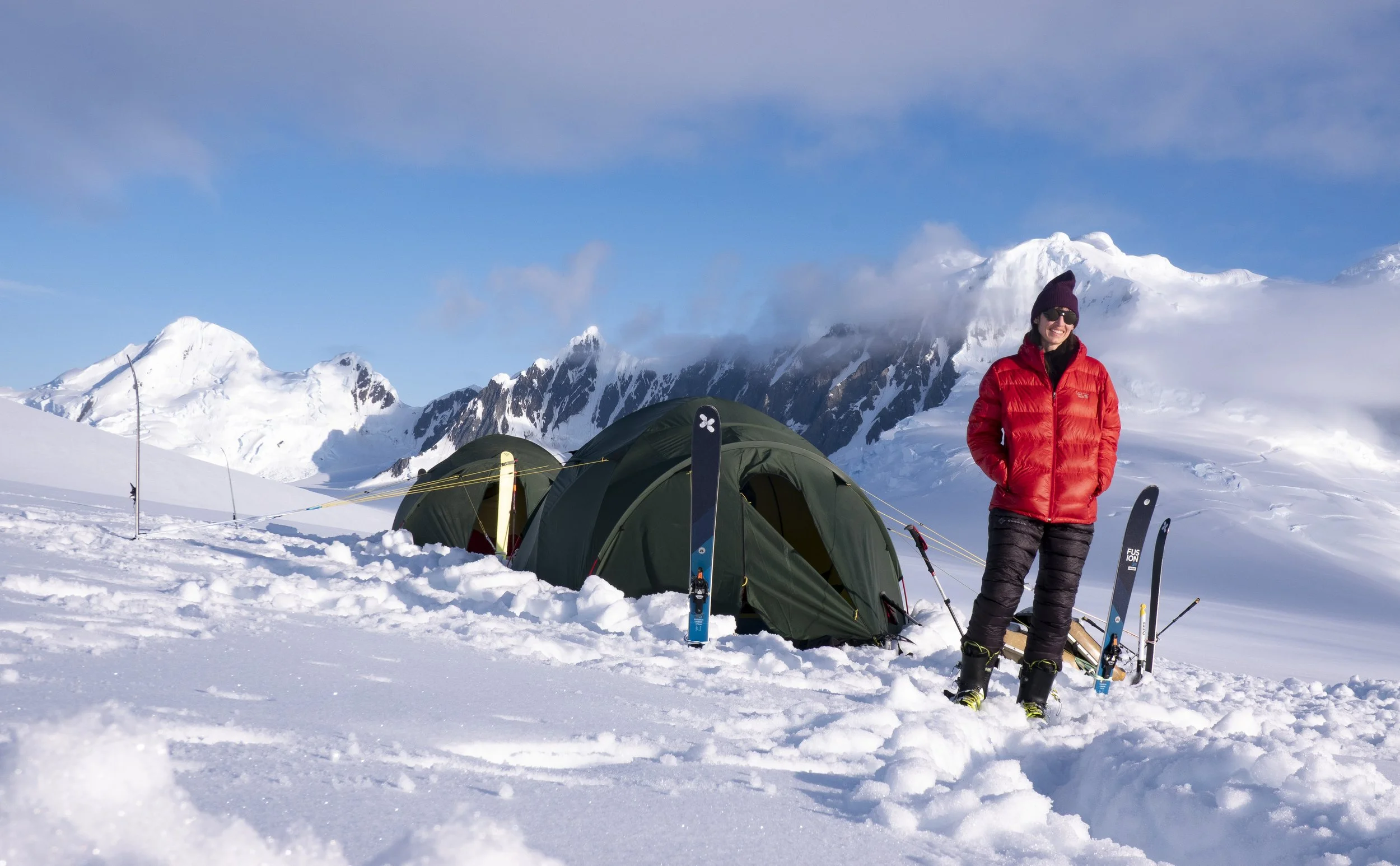
Viola Iselin at Camp 1. Photo: Stephen Venables
Now it was time for the big ‘faff’. According to the Oxford English Dictionary, to faff is to “spend time on unnecessarely complicated and time-consuming actions”. We do a lot of faffing on these expeditions. But our faffing is actually important and necessary. Getting five people clothed, sunscreened, gloved, booted, roped and attached to their skis and harnessed to carefully-packed pulks just takes a long time.
At 9.30 am we were finally ready to depart. That moment of commitment, as the boat sails away, and you start to slide your skis forward, leaning into the weight of your pulk, is always exciting. The seaside sounds of breaking surf and squawking terns recede as you climb into white silence. On the Marr Ice Piedmont that other-worldly atmosphere is often compounded by low-lying cloud, so you travel in a white limbo, dependent on compass and GPS to keep moving in the right direction. In fact the visibility was reasonable on this first day, making navigation easy. We travelled about 10 kilometres then stopped to camp at 460 metres above sea level.
Time for more faffing. On average it seems to take about five hours to flatten the snow, pitch tents, secure guy lines and valances, get organised inside, and then start the long process of melting snow on the gas stove for drinks and dinner (Risotto in both tents that evening), then melt more snow for cocoa with Cognac, and then melt a few more litres to fill flasks ready for the next day’s pulking.
On Day Two we saw nothing. While most of the Antarctic Peninsula glowed in the anti-cyclonic sunshine, we groped our way for seven hours through a featureless fog, stopping mid afternoon at a pre-determined waypoint 781 metres above sea level, a couple of kilometres from the foot of a completely invisible Mt Rennie.
Mt Rennie was still invisible when we left the tents at six o’clock the next morning. I was hoping to find a broad rising shelf I had spotted thirteen years earlier from Mt Français – the perfect crevasse-free ski route to the summit – but I wasn’t sure exactly where it started. Groping around in the early morning fog – then in a brief clearing getting glimpses of menacing, collapsing ice cliffs and no sign of my gentle shelf – it required a younger, cleverer, more tech-savvy Lucas to point out on his Garmin Explorer app that we should be a couple of kilometres further north. As the old cliché has it, ‘time spent in reconnaissance is never wasted’. Too late to get up Mt Rennie today before the snow turned to slush, but in the morning we could come back and hit just the right spot.
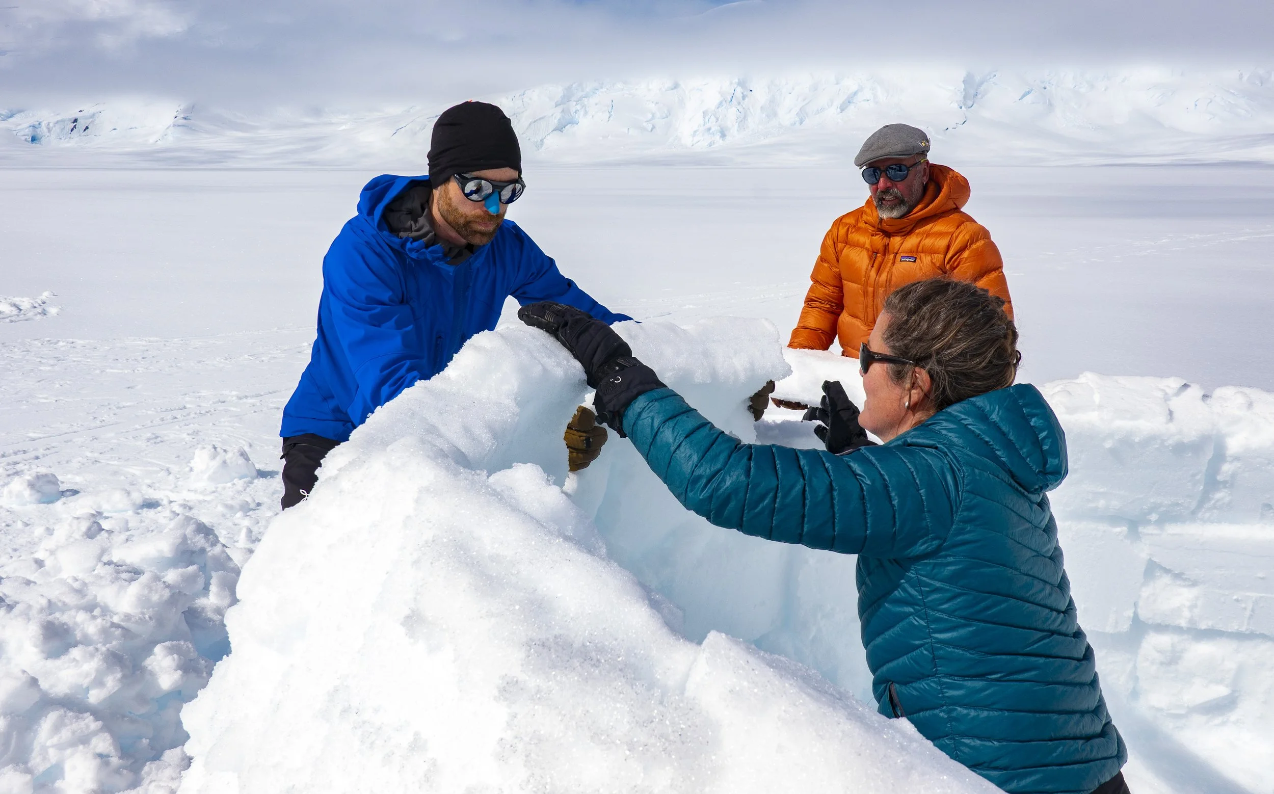
Kristin, Lucas and Manuel building an igloo. Photo: Stephen Venables
So we spent a happy afternoon back at camp. The fog lifted, the sun shone and we amused ourselves building an igloo. Viola was feeling a bit tired and Kristin had a sore pressure point from her ski boots, so alas it was just Lucas, Manuel and I who set off the next morning at 6.50, this time heading in the right direction. For the first forty minutes we were on the flat, just beneath the cloud, aiming for a visible spot on a gently rising ridge. But then we climbed into the fog, unsure of the exact layout of my shelf. Once again techno-man came to the rescue with his Explorer app and pointed out that I had veered slightly too far to the north. I corrected the direction of travel, found the way round a couple of crevasses and then suddenly the cloud lifted, the whole world glittered and there was our summit, just above us!
Except it wasn’t the summit. Too low. Must be a point on the north ridge. So we continued rightward, came ‘round a corner, and there was the upper part of my shelf, undulating amenably upwards to what definitely was the summit of Mt Rennie. This early in the morning the surface, baked and re-frozen repeatedly over the last few days, was still firm and slightly icy. The other two did not have ski crampons and were relying just on the friction of skins as the slope got steadily steeper. So, 200 metres below the top, we took off skis and switched to boot crampons for the final climb to the summit.

Stephen Venables, Lucas Krupp and Manuel Lugli on the summit of Mt Rennie. Photo: Stephen Venables
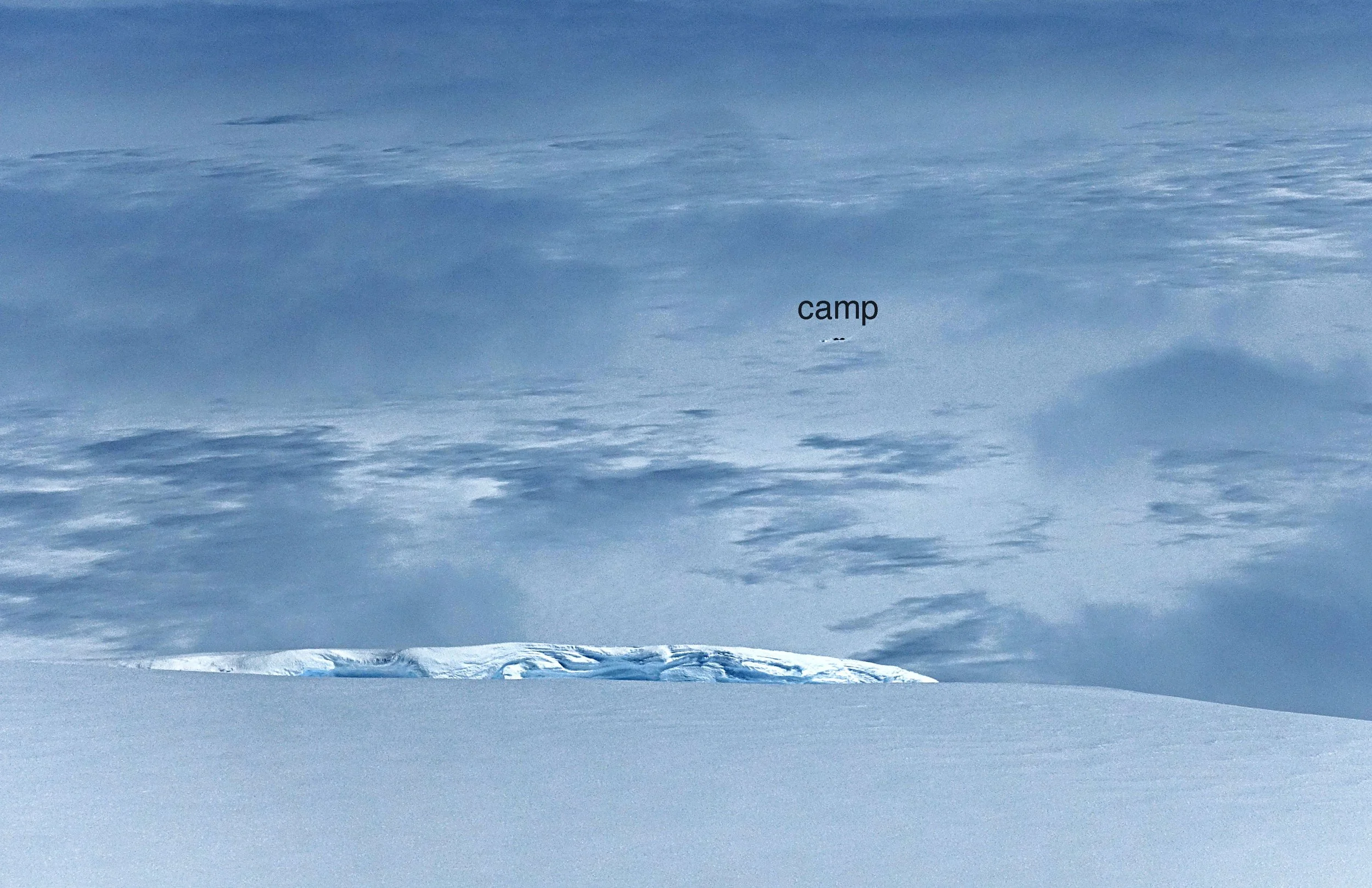
What a summit! A flat spacious space to relax and enjoy the luminous immensity of the Antarctic Peninsula on a perfect morning. Brilliant sunshine as far as you could see. Except for seven-hundred-and-fifty metres beneath us, where the fog lingered stubbornly on the piedmont. But then it cleared suddenly and Manuel spotted two tiny dark blobs – our tents.
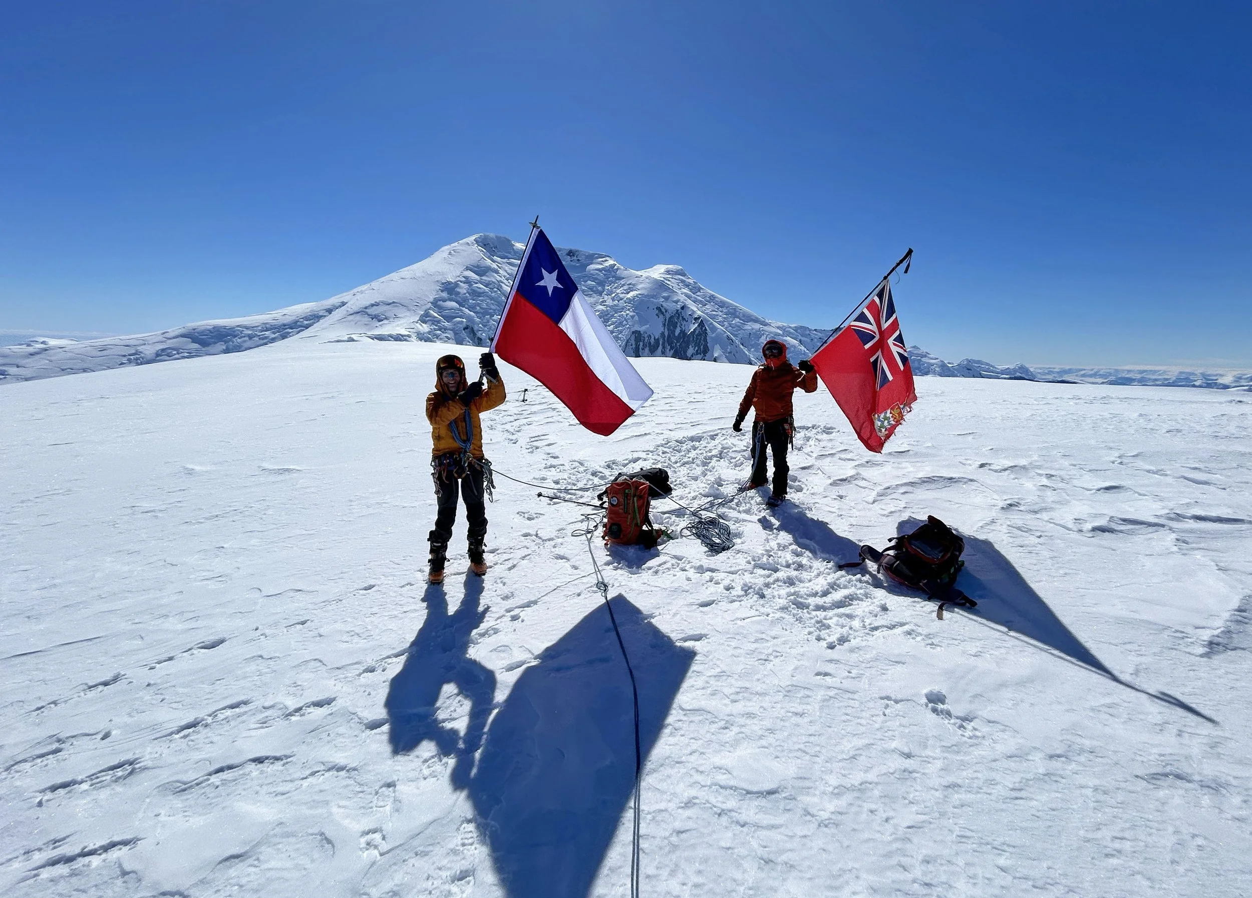
Nicolás’ flag and Amundsen’s Red Ensign on the summit. Photo: Lucas Krupp
Lucas Krupp and Manuel Lugli take off skis just below the summit of Mt Rennie. Mt Français behind. Photo: Stephen Venables
Camp seen from the summit of Mt Rennie. Photo: Manuel Lugli
For once our timing was immaculate. Just as we regained our skis, the surface began to soften to perfect, smooth, creamy spring snow – the sort of snow where skis slice like a knife through butter and you carve easy elegant turns, kidding yourself that you are a good skier. Manuel actually is a good skier and his telemark turns were, as ever, a joy to watch. As we swooped down the surface grew steady softer, but still not too soft. On the final part, we carved through a field of amazing crystals – millions of translucent spindles, perhaps three centimetres tall, suspended vertically on the surface, tinkling beneath our skis.
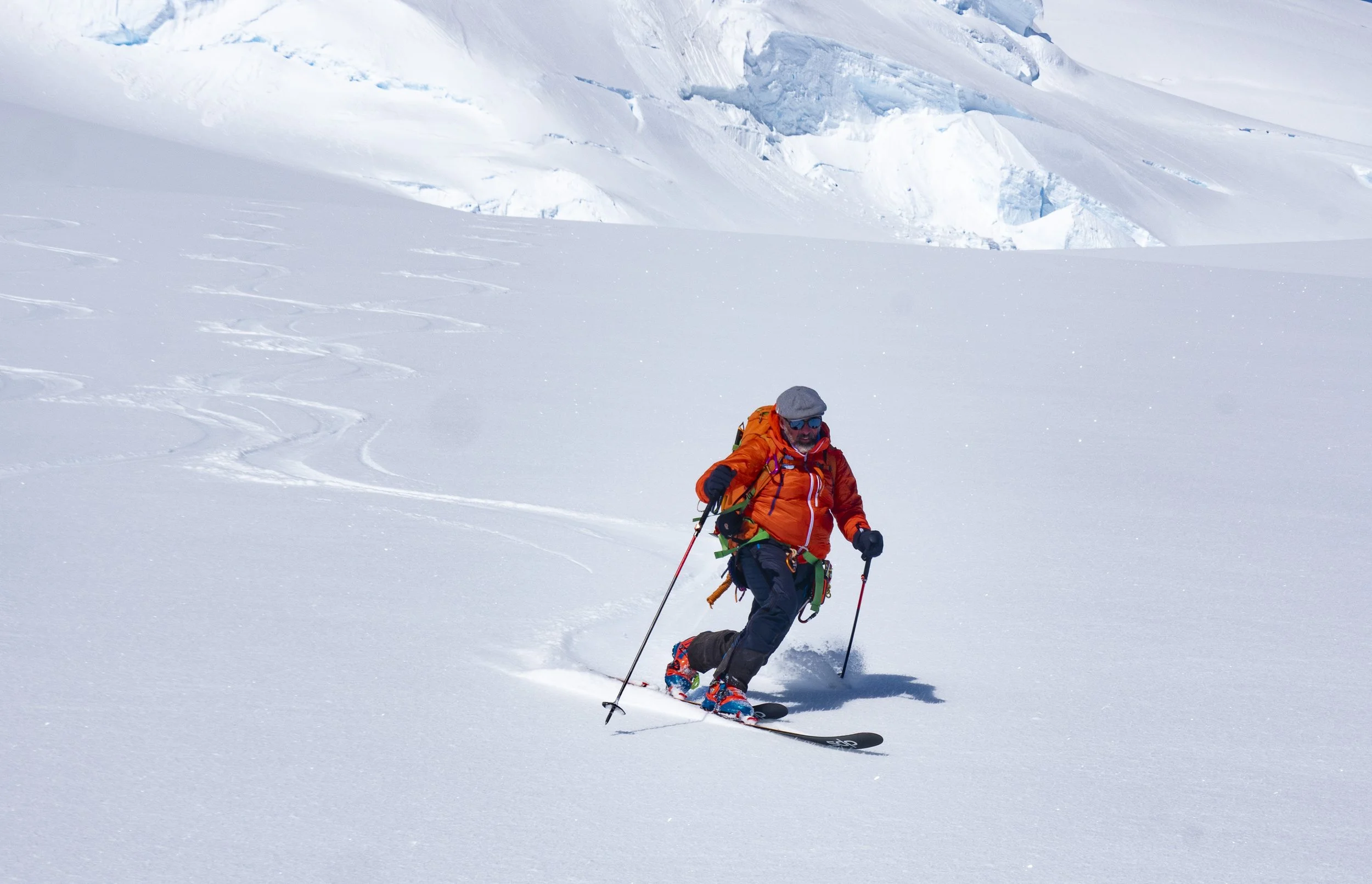
Manuel Lugli telemarking down Mt Rennie. Photo: Stephen Venables
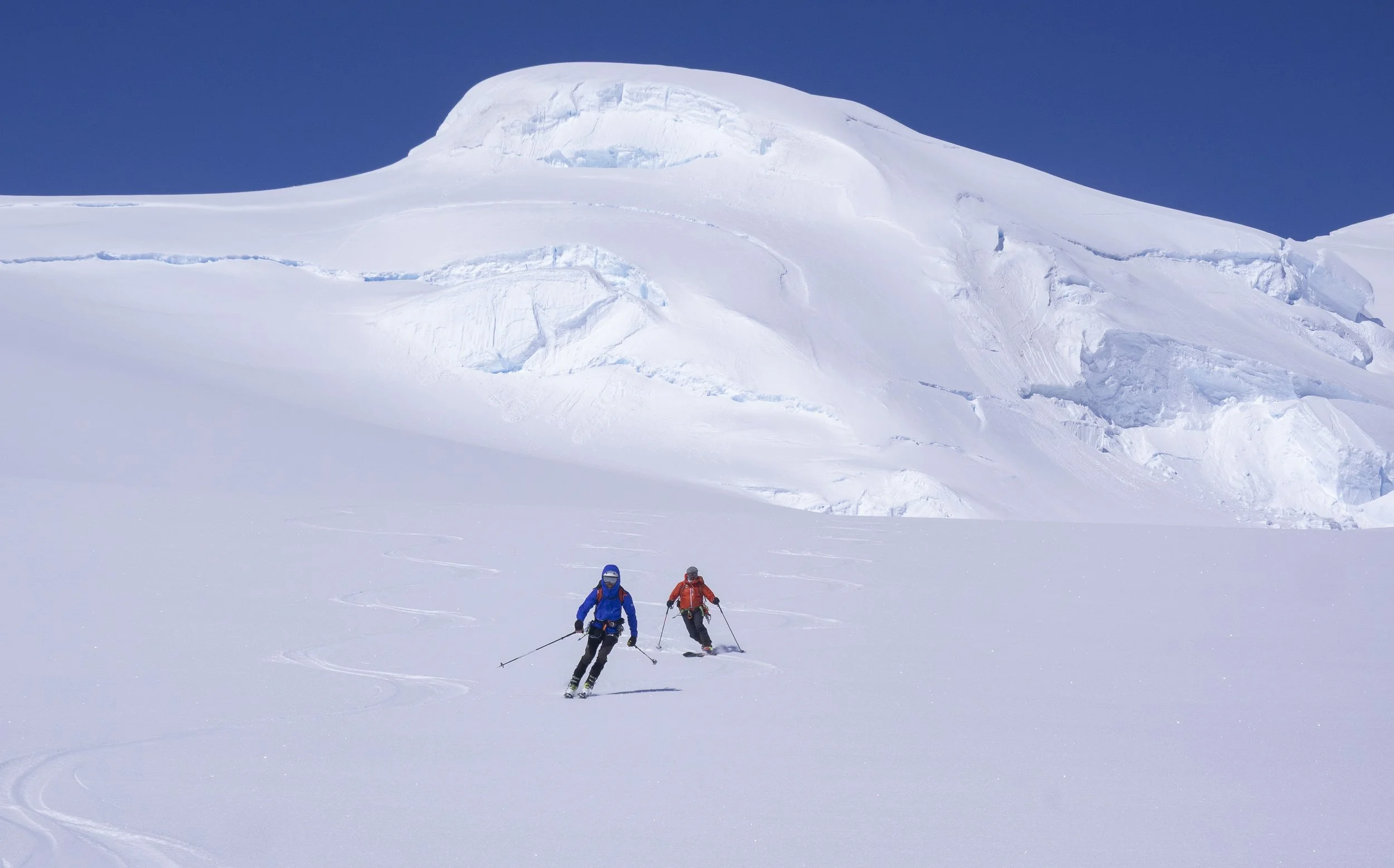
Lucas Krupp and Manuel Lugli descending Mt Rennie. Photo: Stephen Venables

Returning to camp on the Marr Ice Piedmont. Photo: Manuel Lugli
It was all over far too soon, and then we just had a twenty minute horizontal plod back to the tents, where Viola and Kristin were sunbathing. After the fog of the previous three days, it was lovely to enjoy an evening of luminous clarity before retiring early to bed and rising at 2.30 am on Day Five, to breakfast, pack up camp and set off back down to Access Point. On previous occasions, starting admittedly from a slightly higher camp, this return journey had always taken around eleven hours. Today, on a perfect firm surface, with the extra blessing of good visibility, we trundled home in under six hours, reaching Access Point way ahead of schedule, and getting back on board Amundsen in time for lunch. A perfect finish to a perfect outing.
Stephen Venables
Expedition leader